Change Log
2026-02-03 version 0.9.12.5
=- maverick glasses disabled on 32b devices (causes crashes)
- translations
2026-01-27 version 0.9.12.4
=- New, more tolerant waypoint parser
- Intent-based announcement of events (allows other apps to react to XCTrack events)
- Support for modern devices with 16 kB memory pages
- Option to automatically reset map scale to default after exiting pan mode
- Fixed filesystem provider
- Airspeed widget: TAS / IAS configuration (when available)
- Netto vario widget support for external sensors
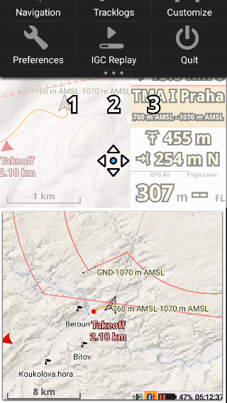
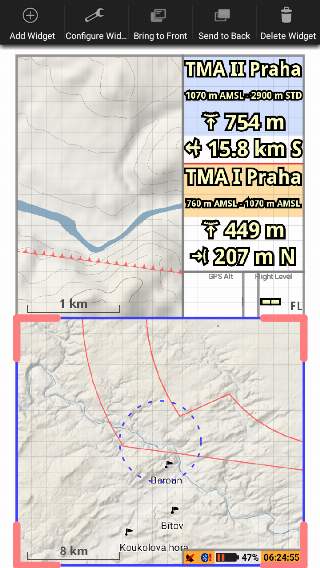
- Configurable list of airspaces in pan mode
- Special fields for Vector Vario (via XCTrack Open Data)
- Various other fixes, improvements and library updates
2025-04-16 version 0.9.12.3 & BETA
- all from previous beta 0.9.12 beta versions:
- simple & easy road map download and import
- New map styles (PRO):
- New theme: Clearpilot
- New relief options, including long-awaited XContest-style colors
- Unified map style selection in map widgets
- Webpage widget (PRO):
- Allow tapping on locked widget for easier in-flight interactions
- JavaScript interface for XCTrack data (for webpage developers)
- Widget add: New filtering of the widget list through text search
- New widget: Last notification
- New display brightness reactions
- Support for a new external sensor: Vector Vario
- Support for new features from external sensors: Air temperature and humidity
- Improved process of flight upload to XContest
- bugfix: map rotation settings
- translations
2025-04-08 version 0.9.12.2 BETA
- NEW: simple & easy road map download and import
- LIGHT legacy terrain view for nostalgists
- Android 15 UI improvements
- FIX: rare crashes connected with airspace display
2025-03-17 version 0.9.12.1 BETA
- bugfixes
- translations
2025-03-13 version 0.9.12 BETA
https://gitlab.com/xcontest-public/xctrack-public/-/milestones/28- New map styles (PRO)
- New theme: Clearpilot
- New relief options, including long-awaited XContest-style colors
- Unified map style selection in map widgets
- Webpage widget (PRO):
- Allow tapping on locked widget for easier in-flight interactions
- JavaScript interface for XCTrack data (for webpage developers)
- Widget add: New filtering of the widget list through text search
- New widget: Last notification
- New display brightness reactions
- Support for a new external sensor: Vector Vario
- Support for new features from external sensors: Air temperature and humidity
- Improved process of flight upload to XContest
- Several bugfixes and many minor improvements
2024-06-21 version 0.9.11.11 & BETA
direct download- connection type choice for dual BT devices
- support for Bluetooth devices with multiple UART services
- fixed takeoff detection on devices with GPS rollover
- other minor improvements
2024-05-26 version 0.9.11.10 & BETA
- MipBip+ faulty connection workaround, battery level on FBMini is received again
2024-05-26 version 0.9.11.9 & BETA
https://gitlab.com/xcontest-public/xctrack-public/-/milestones/25- bugfix of a spontaneous task reset on activity restart
- MipBip+ connection workaround - temporary not reading battery level on FBMini
2024-05-23 version 0.9.11.8 & BETA
https://gitlab.com/xcontest-public/xctrack-public/-/milestones/25- fix translations & other minor improvements
2024-05-15 version 0.9.11.7 & BETA
https://gitlab.com/xcontest-public/xctrack-public/-/milestones/25- all from previous beta versions:
- SafeSky integrations
- multiple external devices with priorities and fallbacks
- internet access for ancient devices
- new map theme (Frenchkiss)
- improved airspace handling (W class, map panning, sorting)
- other improvements and new translations
2024-04-25 version 0.9.11.6 BETA
- fix BLE connection problems (sorry SkyBean)
- SafeSky available for ancient devices
2024-04-15 version 0.9.11.5 BETA
- better livetracking connection stability
- upgrade of the map library (vtm 0.21)
- external sensors improvements & fixes (Renschler, Ch340C, BlueFly)
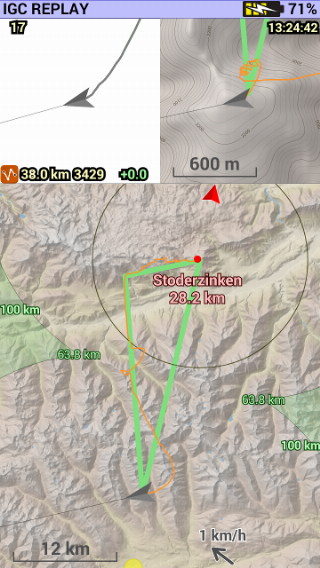
- fix route calculation during IGC replay
- e-readers friendly splash screen
2024-02-27 version 0.9.10.6 & 0.9.11.4 BETA
- access to online services for Android 6.0
2024-02-23 version 0.9.11.3 BETA
- new: access to online services for ancient Androids (<7.1)
- improvement: hide External data widget option if there is nothing to display
- new: TAS reading from BLE devices (FBmini)
2024-02-23 version 0.9.10.5
- new: access to online services for ancient Androids (<7.1)
2024-02-18 version 0.9.11.2 BETA
- fix: bad livetracking handling of the poor internet connection
- fix: import config of a wrong file, permission dialog on Android 10
2024-02-14 version 0.9.11.1 BETA
- improvement: support of multi-service BLE devices
- fix of the rare sudden crash during the startup
2024-02-14 version 0.9.10.4
- fix of the rare sudden crash during the startup
2024-02-08 version 0.9.11 BETA
https://gitlab.com/xcontest-public/xctrack-public/-/milestones/25* new: Electronic Conspicuity (SafeSky) integration
- new: Multiple sensors connectivity with automatic fallbacks
- improvement: new builtin map theme: Frenchkiss
- improvement: airspace handling (W class, map panning, sorting)
- improvement: your relative position while panning a map
- improvement: BLE connectivity, new preferences, new instruments, Android 14 compliance
- new: testing widgets
- other improvements & bugfixes
2023-06-29 version 0.9.10.3 & BETA
- everything from beta versions bellow
- new translations, other improvements & bugfixes (#994 i.e.)
2023-06-26 version 0.9.10.2 BETA
- improvement: labels for obstacles
- new: obstacles in ActiveLook glasses
- new translations, other improvements & bugfixes (#992 i.e.)
2023-06-19 version 0.9.10.1 BETA
- new: obstacles alert customization
- new translations, other improvements & bugfixes
2023-06-09 version 0.9.10 BETA
- improvement: fast vario widgets in ActiveLook glasses
- improvement: unit selection in the Altitude widget (XAlps athletes request)
- improvement: less prone to false takeoff detection
- new translations, other improvements & bugfixes
2023-05-20 version 0.9.9.1 BETA
- bugfixes in obstacle config and airspaces from files
2023-05-19 version 0.9.9.0 BETA
- new: thermal layers in map widgets from thermal.kk7.ch (partially Pro)
- new: obstacle management, obstacle warning and hazard mode in map widgets; obstacle data for Austria, France, Germany, Italy, Slovenia, Switzerland
- improvement: ActiveLook multishaded map widget (upgrade your glasses fw to 4.6.0b or newer)
- improvement: libraries updates
- other improvements & bugfixes
2023-05-10 version 0.9.8.7.1 & BETA
- bugfix in config export
2023-04-27 version 0.9.8.7 & BETA
- new: sharing & importing pages with widgets only
- improvement: modern library for QR scanning
- other improvements & bugfixes
2022-12-12 version 0.9.8.6 & BETA
- new: support for SkyDrop2
- new: support for Horizon builtin module
2022-08-24 version 0.9.8.3 & BETA
- improvement: option for disabling HW acceleration that could cause crashes on some buggy devices
2022-08-15 version 0.9.8.2 & BETA
- bugfix: location widget
2022-07-19 version 0.9.8.1 BETA
- new: more widgets for ActiveLook glasses
- library updates, other minor improvements and bugfixes
2022-05-31 version 0.9.8 BETA
https://gitlab.com/xcontest-public/xctrack-public/-/milestones/26For Android >= 5 only.
- new: cloud task sharing by a simple code #877
- new: ActiveLook glasses support #876
2022-05-27 version 0.9.7.6 & BETA
https://gitlab.com/xcontest-public/xctrack-public/-/milestones/23This is the last version for Android < 5.
For the non-beta users: many new features & improvements from the 0.9.6 and 0.9.7 beta versions like:
- central QNH handling
- XC (route) navigation
- new widgets
- compass, multiple external sensors, built-in fanet support
- a lot of UI customizations
- road map manager
For beta users (changes from 0.9.7.5):
- optional backward flying detector in the speed widget (due to low quality compass in some devices)
- a few improvements and bugfixes; translations
2022-05-17 version 0.9.7.5 BETA
- improvement: share a link to a flight and reupload buttons
- improvement: manual refresh of glider list
- various improvements and bugfixes; translations
2022-04-07 version 0.9.7.4 BETA
- bugfix: USB sensor connection
- bugfix: scan of minimalist QR code
2022-04-04 version 0.9.7.3 BETA
- bugfix: adding waypoint from map to a brand new task
- translations
2022-04-01 version 0.9.7.2 BETA
- bugfix: editing Flarm only records in internal Flarm database
- translations
2022-04-01 version 0.9.7.1 BETA
- the shortest path in task summary is shortest again, not the most advantageous one
- translations
2022-03-21 version 0.9.7 BETA
https://gitlab.com/xcontest-public/xctrack-public/-/milestones/23- new: Multiple external sensors #473
- new: XC (route) navigation with manual switching #657
- new: support for built-in Fanet module in AIR3
- new: Max altitude widget (Pro) #179
- new: Saving (known) FLARM IDs as buddies #616
- new: Brightness info widget (Pro) #834
- new: Negative speed detection #247
- new: Basque language
- improvement: S/ESS cylinder optimizations #283, #776
- improvement: Different units in a widget #787
- improvement: more placeholders in webwidget #804
- improvement: option for disabling external sensor disconnection warning #759
- improvement: SSS crossing option removed #837
- improvement: Compass widget: another wind arrow #788
- improvement: Events with disabled sound warning is not shown #421
- improvement: Drawing a navigation line #659
- improvement: Adding a point to a task from map #664
- improvement: #749, #739, #768, #785, #737, #779, #749, #734, #748, #689, #765, #814, #468, #66, #756, #806, #809, ...
- fixes: #758, #801, #745, #753, #755, #756, ...
2021-06-08 version 0.9.6 BETA
https://gitlab.com/xcontest-public/xctrack-public/-/milestones/20- new: central QNH handling
- new: automatic QNH sync from internet (Pro)
- new: RoadMap manager with one click download
- new: Altitude statistics widget (Pro)
- new: AMSL widget
- new: magnetic compass support
- improvement: new map widget features: smart pilot position on a map, travel direction on the top, heading and bearing independent drawing, adjustable pilot's arrow size, custom tracklog color, hiding zoom buttons in pan mode
- improvement: possibility to force GPS altitude for airspace infringement checks
- improvement: livetracking disabling dialog during startup
- improvement: per widget theme override (useful for maps)
- improvement: tunable widget titles in Preferences > Display: colors (Pro), size and outline (all)
- improvement: custom widget titles (Pro)
- improvement: louder sound and setting for the max volume
- improvement: scanning QR codes from files
- improvement: airspeed from CProbe
- improvement: show averaging interval in widget title (vario, glide)
- improvement: web widget respects transparency setting (Pro)
- improvement: sharing log files
- bugfixes
2021-05-03 version 0.9.5.3 & BETA
https://gitlab.com/xcontest-public/xctrack-public/-/milestones/24- new: livetracking for all
- new: rain radar overlay for map widgets (Pro)
- new: Norwegian and Hindi
- new: FANET external livetracking support
- bugfixes
2021-03-10 version 0.9.5.1 BETA
https://gitlab.com/xcontest-public/xctrack-public/-/milestones/21- new: sharing a tracklog (the igc file)
- new: better rendering of overlapping road maps (use the same map version for best results)
- new: imports by android system filepicker
- new: enhanced storage access (XCTrack is a content provider)
- new: external airspeed from LXWP0, PLKAS, PKTAS1
- improvement: possibility for reversing external wind direction
- bugfixes
2021-02-10 version 0.9.5 BETA
https://gitlab.com/xcontest-public/xctrack-public/-/milestones/19- by Google forced data migration on Androids >= 10 Why?
- new: End of Speed Section related widgets (Pro)
- new: external wind for Digifly and XCTracer (LXWP0, LXWPW, PDGFTL1)
- new: external airspeed for Digifly (PDGFTL1)
- new: volume raising warning
- new: new aircraft types (FAI classes) for microlights
- new: external generic data parsing & widget
- new: map panning keys #654
- new: display brightness keys #614
- improvement: live pilots clustering on a map
- improvement: BLE should work better on most devices
- improvement: deduplication of a 'live' pilot via livetracking and flarm
- bugfixes: #583, #622, #627, #634, #640, #655
2020-08-07 version 0.9.4.5 BETA
- new: airspace auto-update during flight
- new: widget digital compass
- new: airspace alerts/warnings from NOTAMs
- beta: new livetracking protocol
- improvement: better Bluetooth connectivity on recent Androids
2020-05-28 version 0.9.4.4 & BETA
- new: GPS rollover fix for old devices (Preferences > Connection & sensors > GPS)
- improvement: state borders in lightpilot theme
- improvement: more precise XC optimization
- improvement: PRSD protocol for external sensors
- fix: GPS signal reception on devices upgraded to Android 10
- fix: webview for old Androids
- other minor bugfixes & improvements
2020-04-15 0.9.4.3 & BETA
https://gitlab.com/xcontest-public/xctrack-public/-/milestones/17- (beta) more reliable livetracking connection in transition between gsm networks
- fix: GPS signal reception on some devices
- fix: airspace persistency issues
2020-04-06 0.9.4.2 & BETA
https://gitlab.com/xcontest-public/xctrack-public/-/milestones/16- new: QR sharing of URL in webview widget
- improvement: usb connection for new xctracers
- improvement: imperial units in sideview
- improvement: reject call option
- other bugfixes & improvement
- for non-beta version all features from previous betas
2020-03-18 0.9.4.1 BETA
https://gitlab.com/xcontest-public/xctrack-public/-/milestones/15- improvement: switchable obstacle labels
- fix: adding live messages
2020-03-16 0.9.4 BETA
https://gitlab.com/xcontest-public/xctrack-public/-/milestones/14- new: custom sound for acoustic vario (Pro)
- new: obstacle alarm
- new: optional airspace shading
- new: copying page in page layout
- new: optional incoming call rejection (Android >= 9)
- improvement: faster code for airspaces (Android >= 7)
- improvement: better support for 'green' airspaces
- other bugfixes & improvements
2020-02-10 0.9.3 & BETA
https://gitlab.com/xcontest-public/xctrack-public/-/milestones/13- improvement: manual activation for an airspace
- improvement: map readability (labels, colors, thickness)
- improvement: better color scheme for color-blind pilots
- new: support of https://skysight.io website
- other bugfixes & improvements
- for non-beta version all features from previous betas
2020-01-15 0.9.2.1 BETA
- improvement: map library upgrade (VTM 0.13)
- other bugfixes & improvements
2020-01-14 0.9.2 BETA
- improvement: map library upgrade (VTM 0.12)
- improvement: map themes updated
- new: obstacles from airspace.xcontest.org
- new: AGL-AMSL airspaces support
- new: Pro: display brightness widget
- improvement: faster airspace data download
- improvement: Andoid < 5: connection to XContest again (TLS1.2)
2019-12-16 0.9.1 BETA
- new: imported waypoint file (allows modifying scanned task)
- new: external sensor CH340G (thanks Sylvain Pasutto)
- new: support of flyxc.app website
- improvement: more robust QR scanning (+ some fixes)
- improvement: better volume tweaking
- improvement: Pro: better susnset widgets
- improvement: Pro: better searching for waypoints
- bugfix: fullscreen + notch fixes
- other bugfixes & improvements
2019-07-12 0.9.0 BETA
- new: Pro version for donors & supporters
- new: Pro: widget % of a task
- new: Korean language
- new: Vietnamese language
- new: Pro: web view widget
- new: Pro: searching in waypoints
- new: notch support
- new: Pro: front camera support
- new: Pro: sunset & civil twilight widget,
- new: key binding for menu
- new: TCP client functionality
- improvement: bigger cylinders
- improvement: less strict qr code decoding,
- improvement: web view debug
- fix: bearing jitter with external gps
- fix: PTAS parsing
- fix: heading & bearing issues in compass
- change: minimal API version 18 (Android 4.3 Jelly Bean)
2019-03-08 0.8.3 BETA
special version for Air3 with some functions from 0.9.02018-11-01 0.8.2 & BETA
https://gitlab.com/xcontest-public/xctrack-public/milestones/12- improvement: acoustic vario settings in sound menu
- improvement: sideview: show triangle closing and cylinders
- new device protocols: digifly (telemetry: FL2), PTAS1
- other bugfixes & improvements
2018-09-21 0.8.1 & BETA
https://gitlab.com/xcontest-public/xctrack-public/milestones/11- bugfixes & improvements
2018-09-19 0.8.0 & BETA
https://gitlab.com/xcontest-public/xctrack-public/milestones/10https://gitlab.com/xcontest-public/xctrack-public/milestones/9
- new: touchable action widgets (camera, phone, zoom...)
- new: side view widget
- new: acoustic vario with weak lift indication
- improvement: BLE connection stability
- other bugfixes & improvements
- beta features in production version from previous release (except livetracking)
2018-08-16 0.7.2.1 BETA
https://gitlab.com/xcontest-public/xctrack-public/milestones/9- new: doze mode & write permission warnings
- new: expandable widget settings
- new: IGC with extra precision lat/lon
- new: postpone showing high airspaces on a map
- new: possible skip of AMSL in airspace labels
- new: speed in knots
- new: Earth model in a task file
- new: free text widget
- improvement: more precise competition optimization on WGS84
- fix: glide distance mark
- fix: B-record without known location
- fix: acoustic vario in replay mode
2018-06-01 0.7.1.2 & BETA
- bugfix: upgrade from (very) old version sometime crashes
2018-05-30 0.7.1.1 & BETA
https://gitlab.com/xcontest-public/xctrack-public/milestones/8- improvement (beta): livetracking UI: country, takeoff, number of follower
- new: allow forcing location api for devices with problematic GPS
- new: hyperpilot black theme for road maps
- new: lightpilot theme for road maps
- improvement: better auto-connection to BLE external sensors
- improvement: FAI CIVL compliant settings & IGC line
- change: B records without GPS fix every 5 s (was 20)
- fix: C-records times for UK league
- fix: proper change of language on androids 8+
- other bugfixes & improvements
2018-03-20 0.7.0 & BETA
https://gitlab.com/xcontest-public/xctrack-public/milestones/7- 800+ changes
- one year of programming and testing in alpha program
- offline road maps
- e-ink support
- glide indicator
- proximity sensor support
- long key press support
- new widgets
- sharing tasks
- livetracking currently remains in alpha/beta program only (join now)
- bugfixes & other improvements
ALPHA 2018-03-12 0.6.0-817
https://gitlab.com/xcontest-public/xctrack-public/milestones/6- new: glide distance indicator on maps
- new: long key press support
- new: android tweak: keep screen on
- new: UI for deleting downloaded terrain files
- new: new default theme for road maps: hyperpilot
- new: Dutch language
- new: USB ACM connections
- improvement: better terrain in road maps
- improvement: map files can be placed on SD card
- improvement: airspace altitude on zoomed map
- improvement: black on white preferences and settings (e-ink friendly)
- improvement: only modern igc headers
- bugfixes
ALPHA 2017-12-01 0.6.0-675
https://gitlab.com/xcontest-public/xctrack-public/milestones/5- new: cartographic (OpenStreet) maps see About Maps page
- new: creating waypoints, managing airspace, navigate to (long click), pinch zoom in pan mode of a map widget
- new: proximity sensor can act as a hw key (and turn on display): Preferences > Key bindings
- new: previous/next waypoint key binding
- new: airspaces in thermal assistant
- new: load/save task as xctsk file
- new: UDP connection for external sensors
- new: blue fly usb (ftdi) support
- new: basic support of Airwhere
- new: Flymaster as external sensor via USB (limited function due to Flymaster firmware)
- improvement: e-ink theme, better rendering, specific styles of widgets
- improvement: better QR codes for task sharing (it is smaller, so more reliable)
- improvement: faster vertical graph rendering
- improvement: new gliders (fresh list in every next version)
- bugfixes
ALPHA 2017-10-11 0.6.0-513
https://gitlab.com/xcontest-public/xctrack-public/issues?state=all&milestone_title=alpha%20X11- includes previous pre-alpha release
- improvement: everything uses HW acceleration - everything should be OK on motorola phones
- improvement: value widget setting for hiding labels when no value is available
PRE-ALPHA 2017-09-29 0.6.0-489
- new: proximity sensor can be used as virtual hw key
- new: e-ink theme
- improvement: widgets are re-drawing only if necessary
- other improvements & bugfixes
ALPHA 2017-09-07 0.6.0-382
https://gitlab.com/xcontest-public/xctrack-public/issues?milestone_title=alpha+X8- new: CIVL IGC draft compliance
- new: Vertical graph widget
- new: replay / delete flight from tracklog detail
- new: Map widget shows terrain altitude and distance while panning
- new: configurable takeoff detection
- new: wind direction widget
- improvement: created tracklogs should be visible over USB immediately
- improvement: better handling of location links in other applications
- improvement: better list of live flights
- improvement: backlight set by automatic action is applied in other activities too
- [https://gitlab.com/xcontest-public/xctrack-public/issues?scope=all&utf8=%E2%9C%93&state=all&milestone_title=alpha%20X8&label_name[]=bug bugfixes]
ALPHA 2017-07-25 0.6.0-313
- new: paste waypoint coordinates ability
- new: notification bar updates could be switched off
- change: competition distance show decimal when < 50 km
ALPHA 2017-07-24 0.6.0-307
- new: UTM format available in Location widget
- bugfix: livetracking flights list
ALPHA 2017-07-20 0.6.0-302
- new: widgets related to takeoff: distance, height above, course
- bugfix: deleting internal waypoints from waypoint manager
ALPHA 2017-07-20 0.6.0-297
- new: livetracking quick messages
- new: waypoint import via Shared location pin
- new: sort waypoints by name or by distance
- new: smarter open air parser + big warning if some errors appear (X-Alps)
- bugfix: scrolling in spinners on Android 7 devices
ALPHA 2017-07-13 0.6.0-276
ALPHA 2017-07-04 0.6.0-263
this (and newer) version is available only for Android >= 4.0- new: livetracking
- air buddies + their track on map
- messaging + new message widget
- ~100 kB/hour
- new: task declaration (C-records) in IGC
- new: import task from xcplanner
- by clicking Share/Open with XCTrack
- by scanning QR code
- new: immersive mode
- new: android integration: automatic master sync on/off (don’t synchronize email etc. during the flight)
- new: no landing detection option for hike&fly
- new: current status in android notification
- new: possibility of mute phone ringing during the flight (automatic unmuting after landing)
- new: Dragonfly BLE compatibility
- improvement: open task xctsk file from a filemanager
- improvement: menu disappears after 10s
- improvement: map widget: pan mode + manual zoom timeout
- improvement: closing triangle navigation: navigate to the closing circle, when outside, then to the center
- improvement: switch between tabs by swipe
- improvement: airspace: support class Q and W in openair
- improvement: more benevolent .cup file parsing
- improvement: CPU/battery consumption tuning
- improvement: new HFDTEDATE format line in igc
- removed: turn on/off airplane mode from reactions (has been supported only by ancient androids)
- bugfix: respect goal line length
- bugfix: airspace proximity widget vs. AGL based airspace in mountains
- bugfix: too long AXCT line in some circumstances
2017-03-14 0.6.0
- new translations
- new takeoff places and new gliders
- improvement: better BLE connection (XCTracer II, SkyDrop BLE now compatible)
- improvement: Baro Alt has mode suffix in the title (STD, MAN, AUTO)
- improvement: heading line respects thickness settings
- improvement: Next Turnpoint widget shows GOAL! when you reach the goal (instead of nothing)
- improvement: Competition map: closer autozoom near cylinder
- improvement: airspace from web even from files (for your custom airspaces)
- improvement: new default layouts (thanks to Petr Kozisek)
- improvement: page names in page layout settings
- improvement: glider category for FAI-11 a FAI-12 classes
- change: Altitude over goal shows values > -1000 m
- bug fixes & stability improvement
2017-03-06 0.6.0 (devel for translating)
New priviliges required for task sharing: Camera, NFC.- new widgets:
- Air speed
- Next turnpoint height/altitude
- Glide ratio to the next turnpoint
- Next turnpoint time of arrival
- new: settings of navigation target for every navigation widget - you can choose from:
- optimized point
- point
- nearest point on cylinder
- new: Competition task sharing:
- via file (bluetooth, email, ...)
- via QR code
- via NFC
- new: High Contrast themes
- new: settings for thickness of lines in:
- Competition map
- Thermal assistant
- new: WGS-84 or FAI Sphere Earth model
- new: Traditional Chinese support (thanks to Bryan Wu)
- new: more precise and more comfortable settings of cylinder radius
- new: lower repaint frequencies
- new: configurable format for gliding widget
- new: configurable format of time intervals
- new: About in menu
- new: help tips for more complicated widget settings
- improvement: windspeed widget change color according to value
- improvement: better crash reporting
- improvement: Stop button & warning dialog during elevation files download
- improvement: decimal for competition distance < 10 km
- improvement: better labels for airspace on the map
- fix: competition goal sound settings
- fix: line in IGC file won't be longer than 76 characters (according to specification)
- fix: Invalid IGC file annoying warning after landing
- fix: every automatic action in landscape mode should work now
- fix: crashes during creating task in landscape mode
- External Devices
- new connection: IOIO board
- new connection: FlyNet (barodata for all models, external GPS for XC1)
- new connection: Flytec Sensbox as external GPS
- improvement: support for $GN... NMEA sentences
- improvement: USB external device can send different line endings
- fix: external data parsing for west hemisphere (sorry!)
- and big bunch of minor improvements & bug fixes
2016-09-09 0.5.1.6
- improvement: new choose glider dialog: tandem/biplace checkbox, category for unknown gliders
- improvement: faster upload to xcontest.org (3 times) with progress bar
- new connection: XCTracer wired connection via USB
- new connection: SkyDrop BTLE
- new widget: Barometric Altitude with 3 modes and 3 units
- improvement: Heading arrow in TA shows bearing if algorithm is NONE
- minor bugfixes and other improvements
2016-08-13 0.5.1.5
- new connection of external sensors via usb (leGPSBip)
- new wind drift algorithms in thermal assistant (none + particle drift)
- airspace data update: warning if sync is disabled
2016-07-22 0.5.1.4
- new metrics in tracklog detail: max vario peak, elevation drop, total tracklog length
- reset wind computation during take off detection
- fix: max lift & sink computation
- fix: XCTRC external data versus wind computation
- fix: sensbox connection
2016-06-16 0.5.1.3 (development version)
- manual confirmation of landing
- external gps data over bluetooth
- fix crash after click 'Add waypoint' in rotated display modes
2016-05-26 0.5.1.2 (development version)
- XCTracer support (baro data only, protocols: XCTRACER, LK8EX1, LXWP0)
- Greek language
- pure gps altitude into igc
- configurable airspace labels
- proximity widget: near vertical airspace: horizontal info line has color background (instead of vertical line info)
- black theme: changed color of route
- selected airspace downloads into export/import config
- fix for gps chip leap day bug on some devices
- custom font with diacritics
2016-05-10 0.5.1.1 (development version)
-
- lets swype down
-
- projected screen for easily moving widgets to page borders
- handle (dashed circle) for easy moving widgets
- new proximity widget
- illustrative custom arrows for entry/exit airspace
- consistent line order
- shows nearest airspace while being in another one (optional)
- maximized text size for better readability
- configurable split orientation (when showing more than one airspace is necessary) (default automatic)
- configurable postponing warnings about airspaces with high floor
- configurable vertical limits info line (original vs. recomputed to gps altitude)
- sound settings
-
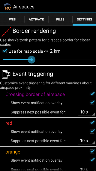
- configurable sharktooth pattern for closer zoom
- near airspace warnings settings
- new events: gps signal established, bluetooth (dis)connected, airspace warnings
- barometric altitude in igc file if available
- flight level widget (if pressure sensor is available)
- glide ratio widget with "show vario in lift" option enabled now computes font size separately for glide/vario (bigger vario text)
- terrain map now renders with page background color instead of blue where terrain data are missing
- terrain map is now displayed by default
- big map widgets on XCAssistant/Competition map pages are no longer special
- any map widget can enter pan mode now, if swype up starts on that widget
- zooming by key presses affect the largest map widget on page.
2014-11-06 version 0.5.1
- included database of large world cities (population >= 50k)
- cities/takeoffs/waypoints now displayable in map widgets
- cities and takeoffs can now act as ordinary waypoints for navigation
- airspace proximity widget: more clever choice of nearby airspace in case of multiple airspaces with similar border/distance
- improved waypoint editing screen
- "competition map" and "time to start" widgets shows "go inside" / "go outside" on the wrong side of start cylinder
- improved algorithm for computing wind
- minor visual improvements
- (wind)speed now shows 1 decimal place if displayed in m/s
2014-06-20 version 0.5.0.5 (development version)
- improved airspace proximity widget, now showing up to two airspaces - closest vertically and closest horizontally
- removed current airspace widget, its functionality is now covered by airspace proximity
- airspace description from https://airspace.xcontest.org displayed on click in the Airspace settings / Activation tab
- configurable units (miles/meters/feet/yards/etc.). See Preferences/Display/Units for details
2014-06-15 version 0.5.0.4 (development version)
- contour labels size and line thickness on terrain map adjusted to device DPI
- fixed terrain map drawing & visual improvements in black theme
2014-06-11 version 0.5.0.3
- terrain map in dark colors for black theme
- terrain map renders slightly faster
- icons on main settings page (thanks to https://www.jirikrivanek.com) - visible only on android 3.0+ though
- minor visual improvements
- improved vario beeping sounds
- bugfix: fixed occasinal crash when using terrain map on low-memory devices
- bugfix: glide ratio vhen < 15 now displays correctly one decimal place (was rounded)
2014-06-03 version 0.5.0.2
- fixed another bug causing crash at start on a few devices
- vario averaging now works for sensors directly reporting vertical speed
- status-line widget improvements
- added bluetooth sensor connection state/sensor battery level
- icons for gps status instead of text
- can now show time (disabled by default)
- vertical speed widget can now display units
2014-05-30 version 0.5.0.1
- fixed crash at start / page customization on some devices
2014-05-29 version 0.5
- more clever landing detection and more strict when high above ground and in strong wind
2014-05-28 version 0.4.9.3 (development release)
- fixed distance texts in Airspace proximity widget
- fixed turnpoint radius texts in Competition task summary widget
2014-05-28 version 0.4.9.2 (development release)
- fai sector is now transparent when inside
- units can be switched on/off for most text widgets
- improved cache management of terrain map tiles - should reduce lags when moving map in "pan mode"
- nicer drawing of a few things
2014-05-22 version 0.4.9.1 (development release)
- reverse ordering of tracklogs on Tracklogs screen in XCTrack/Tracklogs directory
- improved bluetooth sensor chooser screen - now scans devices, supports bluetooth LE (requires android 4.3+ and bt4le hardware), can show pairing dialog (android 4.4+)
- support for Flytec SensBox
- support for LK8EX1 bluetooth devices
- bugfix: vertical speed now works in IGC replay with active barometer sensor
2014-05-17 version 0.4.9 (development release)
- terrain elevation data download in xctrack (settings -> maps)
- status widget: "recording dot" symbol instead of the ugly paraglider icon
- new airspace widget, showing airspaces at the current location
- updated glider models database
- device information now logged into IGC file
- removed "keep android in foreground" option, which was confusing, did not work well on most devices and had nasty side effects
- fix for gps problems on some devices
- donations
2014-05-08 version 0.4.8.6 (development release)
- active airspaces are now used either from openair files or from web, but never from both sources (was confusing..)
- tuned airspace descriptions on map
- fixed flight time computing - for multiple flights within one XCTrack run the time was incorrectly measured from takeoff on the first flight (affects flight time and xc speed widgets)
- distance in xcspeed widget is now computed as the length of flat triangle with allowed 50% closing gap (circumference minus the gap) - previously was measured as the distance of free flight over 3 turnpoints.
- time in xcspeed widget is measured until the time of the lastest xc opti (the speed does not decrease now in-between optimization runs)
- xc optimization (flight routes, fai sectors) now updates every 15 seconds (was 20 seconds) and is slightly more precise
2014-05-07 version 0.4.8.5 (development release)
- bugfix - forgeting competition task setup
- fixed problem with parsing some oziexplorer waypoint files
2014-05-06 version 0.4.8.4 (development release)
- fixed problem with receiving gps position on some devices
- fixed airplane mode crashes on android 4.2+ (airplane mode cannot be altered due to android security policy)
- airspace map now displayed even if there is no valid gps fix
- nicer view in airspace map layer
2014-04-29 version 0.4.8.3 (development release)
- terrain map now works on rotated map widget (other orientation than north at top)
2014-04-29 version 0.4.8.2 (development release)
- fixed occasional crash on XCTrack start & airspaces download/update
2014-04-28 version 0.4.8.1 (development release)
- fixed problem with GPS signal on some devices
- XC speed on course widget
2014-04-28 version 0.4.8 (development release)
- vario bar widget
- system volume (for music stream) set to maximum in XCTrack (configurable)
- automatic airspace/activation download for many countries, data sourced from https://airspace.xcontest.org
- distance to airspace border/airspaces names displayed in map
- Terrain elevation map
- AGL widget
- fixed wind computing
- fixed wifi task transfer
- different method for obtaining GPS data (should fix Geoid/WGS-84 altitude problems on some devices)
2014-01-31 version 0.4.7
- competition task sharing over wifi
- barometer data filtering
- improved acoustic vario
- several minor bug fixes
2013-05-29 version 0.4.6 (development release)
- fixed a bug causing occasional crash on quit
2013-05-28 version 0.4.5 (development release)
- fixed a bug in airspace proximity widget - airspace was not displayed if pilot was horizontally deep inside (far from airspace border)
- changed wind computing algorithm to reflect more immediate wind (as opposed to long term average)
- very simple support for BlueFlyVario and C-Probe (barometer only) - improvements are on the way for the next version
- adjustable threshold and averaging interval for vario sound
- minor bug fixes
2013-04-07 version 0.4.4 (development release)
- airspace proximity widget - first rough implementation, needs some more work in altitude calibration, drawing and maybe connection with map widgets (highlight the airspace shown in proximity)
- improved selection in pan mode - right now this is more or less testing thing, airspace selection will not be default in pan mode - selection mode will have to be temporarily activated
- some small visual tweaks
2013-04-02 version 0.4.3 (development release)
- workaround for nasty feature/bug in JRE on some HTC devices (with android 2.x?), causing failure to load pages layout (blank screen) and causing XContest uploads to fail with cryptic error message
2013-04-01 version 0.4.2 (development release)
- airspace descriptions in "pan mode"
- bug fixes
2013-03-27 version 0.4.1 (development release)
- airspaces support, activating/deactiving airspaces
- very basic display of airspaces in map widgets
2013-03-21 version 0.4
- Triangle closing rule can now be set to fixed distance (as opposed to percentage)
- New widget: bearing
- Changed thermal core detection algorithm
- Detected thermals can now be displayed on top of map widgets - still experimental and may not show up very useful, needs testing
- Fixed a bug in page customization with different device orientation than is the one locked in system (if the android has locked orientation)
- Minor bug fixes in XContest upload, added "public flight" checkbox in the first upload step
2013-03-12 version 0.3.6
- XCAssistant shows min/max triangle length for fai sectors
- Configurable displaying of small "north direction" compass on thermal assistant, xc assistant, competition map
- Configurable screeen repaint frequency
- New default layouts, separate defaults for large and small displays
- Some UI improvements
- Fixed screen blinking after orientation change on some devices
- Many minor bug fixes
2013-03-05 version 0.3.5 (development release)
- fixed overlapping descriptions of leg distance/percentage in XCAssistant
- added option to Email exported configuration
2013-03-02 version 0.3.4 (development release)
- Fixed goal line drawing on rotated competition map
- Fixed down-wind rotation of maps
- XCAssistant
- improved drawing of FAI sectors
- on the first leg, the sectors are drawn on both sides
- on the second and third leg, only needed sectors are painted to reduce mess on the screen
- painted optimum direction for extending FAI triangle (the blue line)
- Added icons to map/edges of xc assistant and competition map to mark important directions
- navigation to next turnpoint
- wind arrow
- sun
- Tuned graphics a little for large displays
- Triangle closing navigation: next turnpoint name is now the type and length of triangle
- Fixed crash on waypoints screen (dismissing the FILES tab if no waypoint files were present)
- Improved "up" actionbar icons in navigation screens to make more obvious they are clickable
2013-02-13 version 0.3.3 (development release)
- configurable rotation (north at top / bearing at top / ...) for thermal assistant, xc assistant and competition map
- improved thermal assistant
- configurable track length in thermal assistant
- new widget: altitude gain in current lift
- new widget: air time
- configurable displaying of FAI triangle areas, leg distance/percentage and triangle closing circle in XC Assistant
2013-02-05 version 0.3.2
- Edit/View modes for competition task split into 3 tabs on one screen - edit/fly/result
- fixed background transparency/draw border settings for thermal assistant widget
- fixed background transparency settings for task summary widget
2013-02-05 version 0.3.1 (development release)
- Configurable device locking on power button press - see preferences -> android - no locking by default (dim screen only)
- Replaced menu with ActionBar in navigation screens
- fixed colors in competition navigation setup screens (black text on black background on some devices)
- internal waypoint management - add/delete/edit waypoints
- waypoint files chooser moved from preferences to navigation subscreen
2013-01-22 version 0.3
- fixed reverse portrait/landscape modes on some screens
2013-01-21 version 0.3pre1 (development release)
- turnpoint switch & task result screen for competition navigation
- competition widgets
- reverse portrait/landscape display orientation for devices which support it
- thermal assistant now available as a single widget to put on any page
- some ui changes
- ability to export/import configuration (see Preferences -> Testing&Debug)
2012-12-07 version 0.2.6 (development release)
- pan mode for map widgets (xc assistant, competition map)
- support for cambridge waypoint file format (used in XCSoar, WinPilot)
- some minor improvements
2012-12-04 version 0.2.5 (development release)
- competition navigation (some features still missing, eg. manual turnpoint switching/task restart and many widgets...)
- competition map widget
- some simple competition widgets
- map scale displayed for XC Assistant and Thermal Assistant widgets, nicer map scale settings
- added option to disable logging in Preferences/Testing & Debug/Logging (disabled by default)
- fixed page customization error in case of left-out pages
- fixed map scale settings for XC Assistant widget
2012-11-28 version 0.2.4 (development release)
- show distance both to cylinder and to the point of best closing point for triangle closing (next-turnpoint-distance widget) & clear indication whether the triangle is closed
- pages can be set up to be visible only for specified navigation types (see Preferences -> Pages layout)
2012-10-31 version 0.2.3 (development release)
- competition task setup screen dialog (just to ease language translations, no competition navigation yet!)
- support for barometric sensor
- gps altitude adjustments
- simple acoustic vario
- improved "averaging" of altitude changes (for both gps and barometric altitude, should improve thermal assistant, vario and glide ratio widgets)
- bug fixes
2012-10-11 version 0.2.2.1 (development release)
- added language selection (preferences -> display -> language)
- improved error reporting
2012-10-04 version 0.2.2
- Added navigation to waypoint and related stuff (working with waypoint files, see Preferences -> Waypoints). Supported waypoint file formats:
- Compe GPS .wpt
- Format UTM .wpt, .utm
- GpsDump (GEO) Format .wpt
- OZI Explorer .wpt
- Seeyou .cup
- Added possibility to download development release of XCTrack with the latest localization (Preferences -> Testing & Debug -> Update XCTrack)
- Czech translation
- Improved touchscreen page switch
